Kurnell
Kurnell, Sydney: The Leap, The Steps and the exits that are easy to miss, mapped over five dives and 16 km of GPS tracing.
Five dives and 16 km of GPS tracing with a sea scooter, about 60 hours between the water and the computer. The survey concentrated on the parts that matter most — and on the exits, which are easy to miss.
Conditions today: this site is Leap & Steps and Monument on the VIZ Forecast.
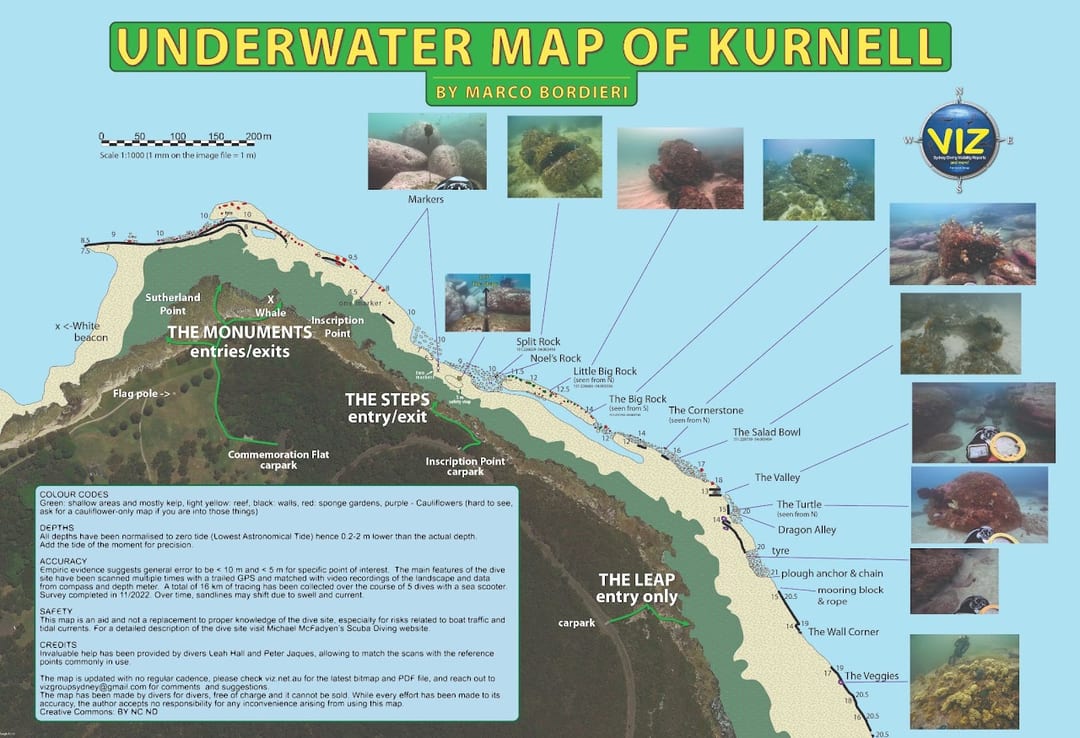 The Kurnell map
The important information is in the box on the map itself — read it. The image on this page is not the full resolution file; the PDF zooms without limit, which is why it is the recommended one despite the size.
First edition published 19 November 2022. If you spot anything that could be better, reach Marco Bordieri on Facebook or email [email protected].
The Leap to The Steps
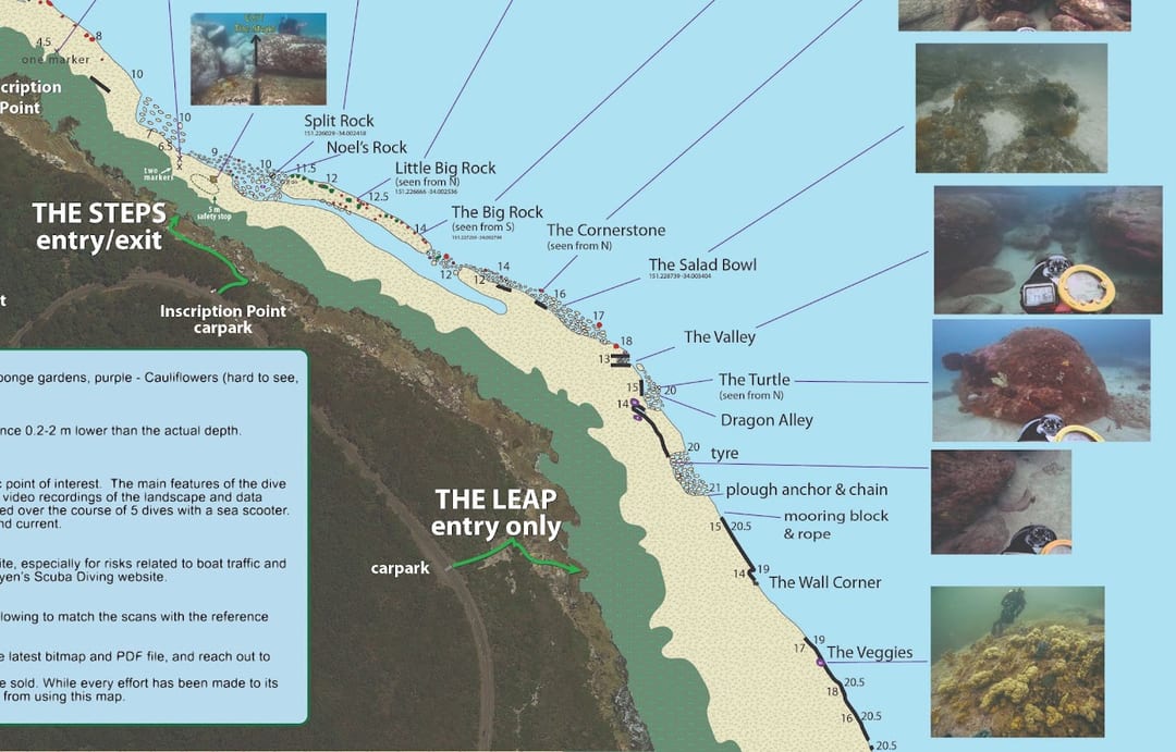 The Leap to The Steps
The Steps
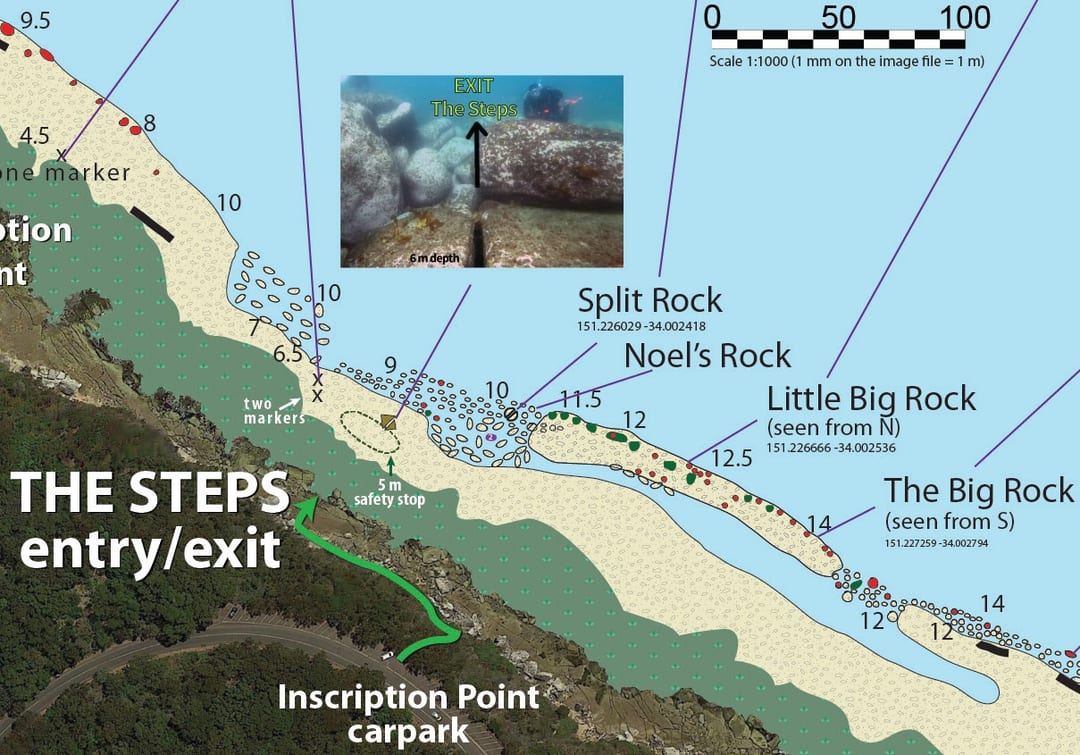 The Steps in detail
The Steps to The Monuments
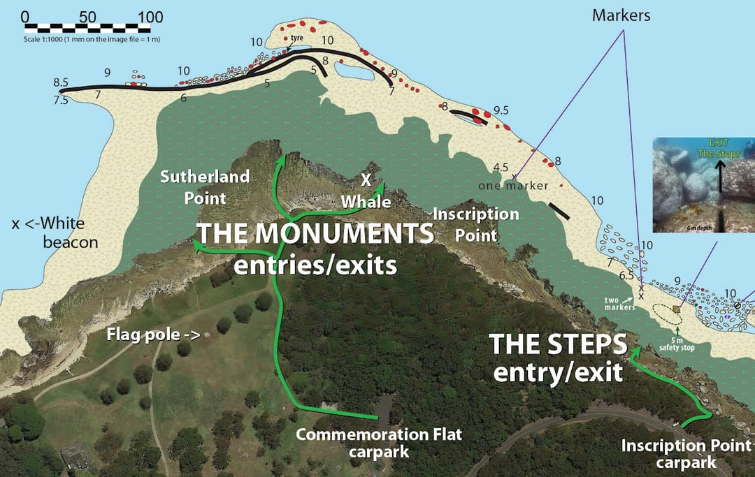 The Steps to The Monuments
The Monuments
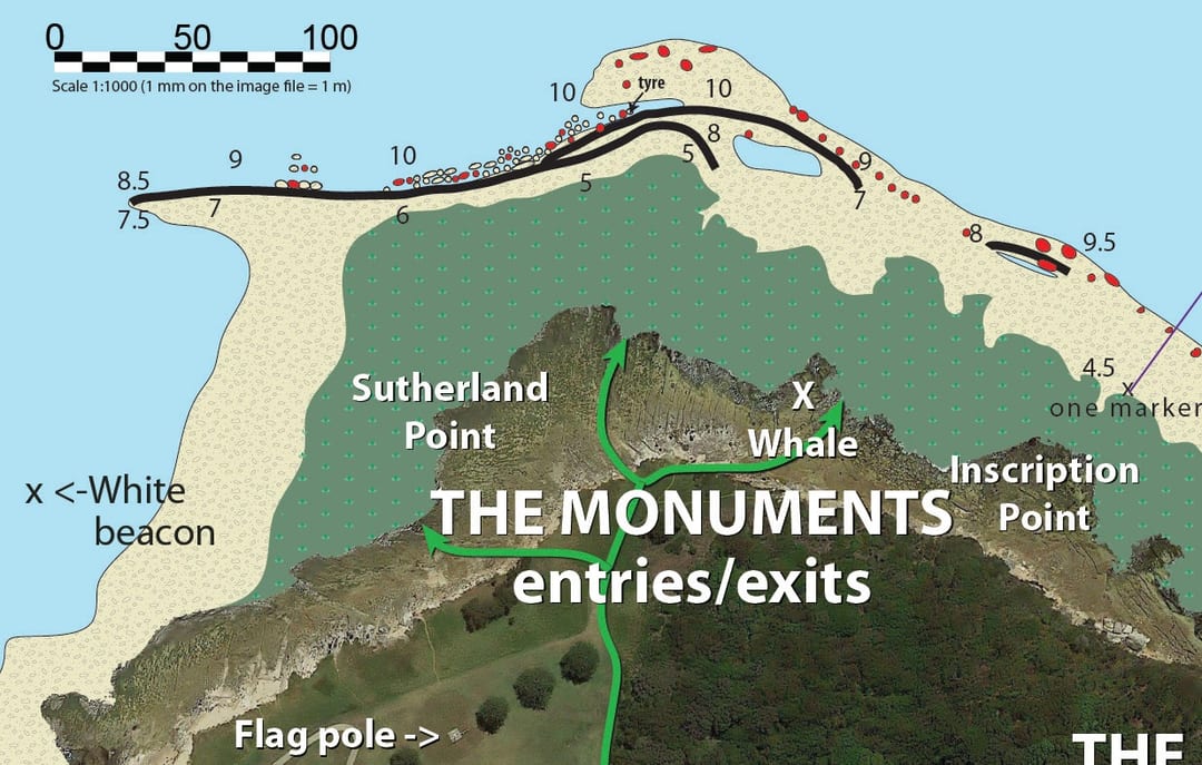 The Monuments in detail
What there was before
For comparison: the best overall map of this stretch until now, from SEED, the NSW Government's bathymetry.
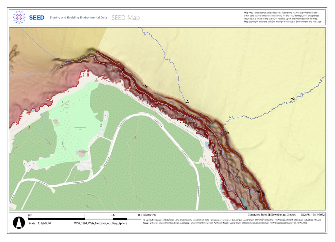 The SEED bathymetry of the same stretch of coast